Download
Project Brochure
-
Hedwige-Prosper Project

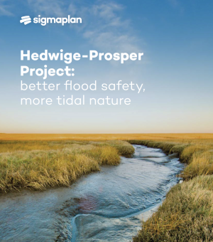
Hedwige-Prosper Project: better flood safety, more tidal nature

24 May 2024

Download Download
Scheldekaaien2024
Scheldekaaien in 2024, ©Thomas Bruyninckx
View project
The Scheldt Quays in Antwerp

Scheldt Quays

View project View project
Kalkense Meersen, ©Yves Adams
View project
The Kalkense Meersen Cluster

The Kalkense Meersen Cluster

View project View project
PDK2025©Vilda
In- en uitwateringssluis, Polders van Kruibeke in 2025, ©Vilda
View project
Polders of Kruibeke

Polders of Kruibeke

View project View project

The winter riverbed is the area a river takes up in winter. There is more precipitation in winter than in summer, which causes the river to expand outside its narrower summer riverbed. The water will remain in the winter riverbed until it flows back to the river naturally, soaks into the ground or evaporates. If we restore the winter riverbed in certain places, we give the river more room to flood safely. The natural relief or local levees protect the hinterland.

Tidal willow forests are forests of high-growing willows in the natural flood zones of large rivers.

In the context of the Sigma Plan, wetlands are marshy areas that are unaffected by the tides. The groundwater there is high in winter and drops in summer. The landscape can range from open water and reed beds to alluvial forests and wet grasslands.

A water barrier wall is an artificial elevation in the landscape in the shape of a wall created to protect the area behind it from flooding

A water barrier is an object or structure that is used to hold back water. Some water barriers are fixed. They can't be moved. Examples of this are levees, slopes, buildings or even street furniture. Other water barriers are mobile. They can be moved and are only activated when there is a risk of flooding.

TAW is the benchmark used for height measurements in Belgium. A TAW height of 0 metres is equivalent to the average sea level at low tide in Ostend.

Tweede Algemene Waterpassing (TAW) translates as second general water benchmark. It is the benchmark for height measurements in Belgium. A TAW height of 0 metres is equivalent to the average sea level at low tide in Ostend.

mail

Op de hoogte blijven?
Schrijf je nu in op de nieuwsbrief.

Wil je op de hoogte blijven van het laatste nieuws over het Sigmaplan? Schrijf je dan in voor de digitale nieuwsbrief.

Schrijf me in voor de nieuwsbrief

help_outline

Any further questions?
Contact us.

If you have any questions or suggestions, get in touch and we will be happy to help.

Go to contact